El Niño is one of the strongest natural influences on winter weather across North America. When it develops, unusually warm sea-surface temperatures in the equatorial Pacific alter atmospheric circulation, including the position and strength of the jet streams that steer storms and Arctic air. For Canada, that shift has historically favoured milder conditions across much of British Columbia, the Yukon and the Prairies, while the signal becomes weaker and less consistent farther east, according to analyses from Environment and Climate Change Canada and NOAA.
Under normal conditions, trade winds push warm surface water toward the western Pacific and allow cooler water to rise near South America. During El Niño those winds weaken, so warm water spreads eastward. The extra ocean heat changes the large-scale atmospheric circulation. The jet stream, which acts as a steering current for weather systems, often shifts in a way that allows milder Pacific air to reach western and central Canada more frequently and reduces the number of prolonged Arctic outbreaks, NOAA and Canadian climate researchers have found.
For British Columbia and the Yukon, many El Niño winters bring a greater chance of above-average temperatures. Southern British Columbia and lower-elevation mountain areas can see reduced snowfall, although individual storms can still deposit significant snow. The Prairies show one of the clearer signals: Alberta, Saskatchewan and Manitoba have tended to experience above-average winter temperatures during strong events, with some of the largest warming anomalies historically appearing around Manitoba and western Ontario, according to historical analyses cited by Environment and Climate Change Canada and ClimateData.ca. Residents can still face major snowstorms and sudden cold snaps even when the seasonal average runs warm.
Less winter snow can affect more than recreation and snow removal. Snowpack helps maintain soil moisture into spring. When accumulation is lighter, less moisture may be available for crops and water supplies, particularly if dry conditions continue, Environment and Climate Change Canada and related agricultural assessments have noted. The relationship is not automatic. Some past El Niño years were followed by warmer and wetter springs that supported production, including spring wheat. Reduced snowpack and prolonged dryness can also contribute to elevated wildfire risk the following season, although actual fire activity depends on spring rainfall, summer temperatures and vegetation conditions.
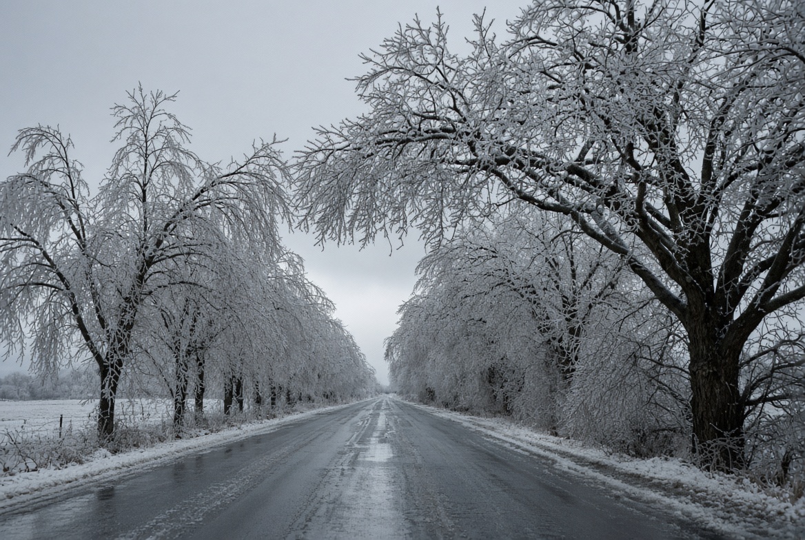
Ontario and Quebec more often show a weaker and less consistent warming signal. Above-average temperatures are more common during strong events, yet cold outbreaks and major snowstorms remain possible. One frequently cited example is the January 1998 ice storm that struck eastern Ontario, southern Quebec, New Brunswick and parts of the northeastern United States during one of the strongest El Niño events on record. Prolonged freezing rain coated trees, roads and power lines. Researchers have examined how the larger circulation associated with El Niño helped create favourable conditions, while also noting that blocking high-pressure systems and other factors were important, according to peer-reviewed studies. El Niño does not automatically produce ice storms; it can influence the broader patterns that make certain events more or less likely.
Atlantic Canada generally experiences a mixed and weaker El Niño signal. New Brunswick, Nova Scotia, Prince Edward Island and Newfoundland have seen milder-than-average temperatures during some events and more unsettled conditions during others. Coastal storms and the North Atlantic Oscillation, another major climate pattern, can override or reinforce the Pacific influence, Environment and Climate Change Canada analyses indicate. Snow removal and winter driving can therefore remain part of the routine even when the seasonal outlook leans milder.
The jet stream is central to these shifts. Warming in the tropical Pacific can strengthen and displace the subtropical jet and alter the path of the polar jet, often favouring a more west-to-east flow or a track farther north. In some strong events the jet can split, directing storms farther south into the United States while large areas of western and central Canada stay warmer and drier. Other atmospheric patterns can temporarily override the typical El Niño influence, which is why no two winters follow exactly the same script, NOAA and Canadian researchers have emphasized.
El Niño typically develops every two to seven years. Events often begin in northern spring or summer, reach peak strength in late fall or winter, and weaken the following spring or summer. Strength is measured primarily by sea-surface temperature anomalies in the Niño 3.4 region of the equatorial Pacific. The Oceanic Niño Index averages the anomaly over overlapping three-month periods; an anomaly of at least 0.5 °C above average sustained for five consecutive periods is the standard threshold for El Niño conditions. The strongest events, sometimes called super El Niños, include the winters of 1982–83, 1997–98 and 2015–16, when anomalies exceeded 2 °C and produced notable warming across parts of Canada.
Canada’s average temperatures have been rising over time even without El Niño. When a strong event develops, its influence occurs on top of that background warming, so a winter that might already have been milder than historical averages can run warmer still, according to Environment and Climate Change Canada and climate researchers. Scientists continue to study whether climate change is altering the frequency or intensity of El Niño itself; no simple rule has been established that every future event will be stronger.
El Niño remains one of the more useful signals for seasonal forecasting, yet it does not determine the weather in any particular city or week. A strong event raises the odds of milder temperatures and, in many areas, reduced snowfall across western and central Canada, while Ontario, Quebec and Atlantic Canada show more variable results. Other patterns, including the North Atlantic Oscillation and Arctic Oscillation, can push conditions in a different direction. Even when seasonal temperatures end up above average, cold snaps, snowstorms and freezing rain remain possible. For Canadians, the practical takeaway is that El Niño changes the odds rather than writing the outcome, and snow shovels should stay within reach.
SOURCES: Environment and Climate Change Canada, ClimateData.ca, NOAA, The Canadian Encyclopedia, peer-reviewed climate research.